Modelling and mapping soil biodiversity patterns and functions across Europe
The status and trends in soil biodiversity across Europe are poorly known, and adequate taxonomical and functional indicators are needed to evaluate the vulnerability of soils to climate change.
To fully comprehend the role of soil biodiversity and its ecosystem functions in the context of climate change, sustainable development and nature conservation, we need to invest in understanding what lives below the ground. The relationship between below-ground biodiversity and ecosystem functions is being investigated in the MINOTAUR project.
Despite recent efforts by scientists and policy makers, the status of soil biodiversity across Europe is poorly understood. It is also unclear how impacts driven by climate change on soil biodiversity will affect soil multifunctionality.Appropriate taxonomical and functional indicators are therefore needed to evaluate the vulnerability of soils to climate change.
MINOTAUR aims to provide models, maps and policy-relevant indicators with validated reference values for monitoring soil biodiversity and associated functions.It also aims to understand how agricultural practices can contribute to climate change mitigation and adaptation at regional and national levels across the EU. The project will collaborate with relevant EU research projects, international soil biodiversity networks and programmes to harmonize and integrate soil biodiversity data and contribute to supporting long-term harmonized EU soil information and international reporting.
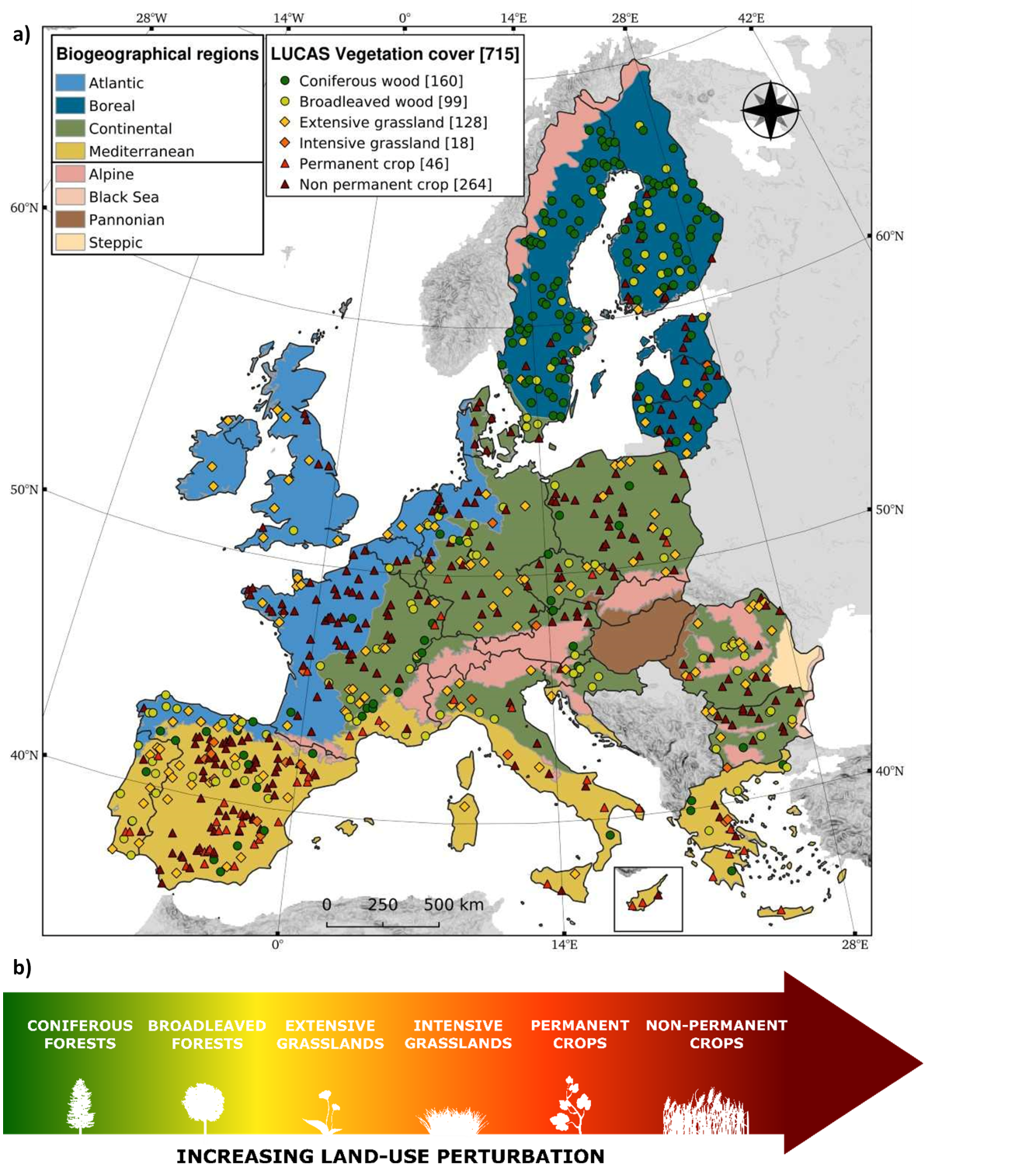
The Agroscope team is currently using the LUCAS database (Land Use/Cover Area frame statistical Survey) to evaluate how soil biodiversity predicts patterns in ecosystem multifunctionality. Specifically, the Agroscope team has accessed 715 LUCAS data points (Figure 1) with detailed information on soil biodiversity (bacteria, fungi, protozoa, etc.), ecosystem functions (primary production, enzymatic activity, soil respiration, etc.), soil properties and climatic data. These points represent a scale of land-use perturbation (from coniferous forests to intensively-managed croplands) and can be used to investigate how soil biodiversity influences the provision of multiple ecosystem functions.
Project Partners
- INRAE
- WR
- CZU
- Teagasc
- CREA
- ULBF
- CSIC
- SLU
- ACO
- BOKU
- CNR
- ISPRA
- ENEA
- ERSAF


