- 2015–2019: First survey cycle:
Mapping is carried out between April and August. Each year, one-fifth of the 170 survey squares spread throughout Switzerland are mapped. - 2020–2021: Comprehensive assessments of the state of biodiversity
- 2020–2024: Second survey cycle
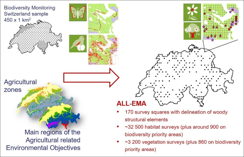
- Data for ALL-EMA are collected from 170 survey squares. Only the agricultural landscape is sampled within the 1km2 survey squares, e.g. forests and settlements are ignored. The balanced selection of survey squares allows us to derive representative results for the individual agricultural zones and the main regions of the agriculture-related environmental objectives. Data on butterfly occurrences on transects are recorded by Biodiversity Monitoring Switzerland BDM, whilst data on breeding territories of the breeding birds are collected by the Common Breeding Bird Survey MHB.
- Using aerial images, ALL-EMA stereoscopically records woody structural elements within the survey squares in collaboration with the Swiss Federal Institute for Forest, Snow and Landscape Research WSL. This produces a detailed map illustrating hedgerows and shrubs, individual trees and groups of trees as well as individual bushes and groups of bushes.
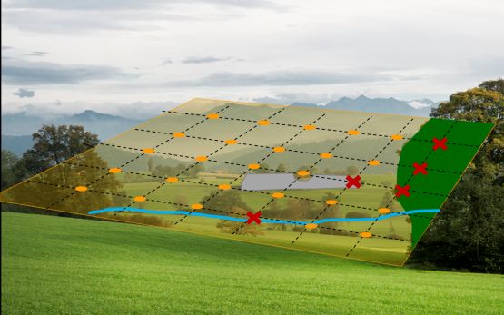
- Within the agricultural landscape of each survey square, a regular 50-metre grid defines the sampling points for data collection in the field, the so-called habitat survey.
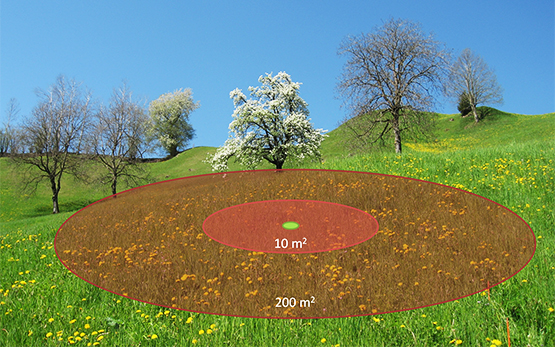
- For each grid point, habitat type and diversity of characteristic habitat-type species are determined on a circular area of 10m2.
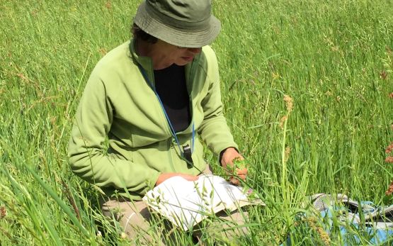
On an extended circular area of 200m2, neophytes on the Black List and structures of the agricultural landscape such as piles of branches, clearance cairns and small water bodies are recorded. A GPS device is used to navigate to the grid points, and data is entered directly into a smartphone. - Detailed vegetation surveys (circular areas of 10m2) are conducted in each survey square on around 10% of the habitat surveys.
In biodiversity promotion areas (BPAs), both habitat and vegetation surveys are additionally conducted outside of the 50-metre grid. The selection process for these surveys is intended to yield sufficiently large samples for statistical evaluations of as many types of BPAs as possible.
Schedule
Contacts
Data reference:
Flyer / Publication
Further Information
Methods