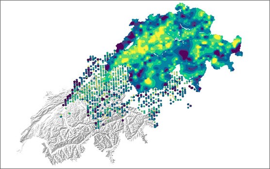
Element concentrations in the topsoil
Elements in soil taken up via the food chain can be essential – or harmful – to living organisms, depending on their concentration and bioavailability. In addition to the ability to delimit potentially contaminated sites, an understanding of typical concentrations ranges of elements in Swiss topsoils is vital for monitoring and enforcement tasks.
The Federal Office for the Environment (FOEN) together with the cantonal environmental protection agencies’ working group on ‘Intervention levels and risk assessment’ (AGIR) commissioned a consortium comprising Agroscope, ETH Zurich and the Swiss Federal Institute of Aquatic Science and Technology EAWAG to compile a Geochemical Soil Atlas of Switzerland. The atlas depicts the spatial distribution and key statistical parameters of 20 elements (antimony, arsenic, cadmium, calcium, chromium, cobalt, copper, iron, lead, magnesium, manganese, mercury, molybdenum, nickel, sodium, sulphur, thallium, uranium, vanadium and zinc) in the topsoil, as well as the soil properties pH, organic carbon, nitrogen and texture.
The Geochemical Atlas is the first evaluation of soil analyses to cover the whole of Switzerland with a resolution of around one sampling site per 35 km2. As such, it provides an important basis for implementing soil-related measures. Based on the information obtained, further targeted regional investigations can be initiated and carried out.
The findings of the Geochemical Soil Atlas represent a snapshot of element concentrations in Switzerland's topsoil. The interpolated maps serve to highlight regions with high or low concentrations, although no plot-specific information can be derived from them.